![](/images/other/stat-length.png)
![Randonnée Marche La Roche-sur-le-Buis - La Montagne de Banne, 1382m - Photo](https://media.geolcdn.com/t/1900/400/ext.pjpeg?maxdim=2&url=https%3A%2F%2Fservices.sitytrail.com%2FGeolivesWS%2FDownloadMedia.ashx%3FTrailID%3D105084%26Media%3D8674_1.jpg)
La Montagne de Banne, 1382m
tracegps
Utilisateur
![Longueur](/images/other/stat-length.png)
![Altitude max](https://static1.geolcdn.com/siteimages/upload/files/1508320355ic_sort_altitude_max_24dp.png)
![Dénivelé positif](https://static1.geolcdn.com/siteimages/upload/files/1508320355ic_sort_den_pos_24dp.png)
![Km-Effort](/images/other/stat-length.png)
![Altitude min](https://static1.geolcdn.com/siteimages/upload/files/1508320355ic_sort_altitude_min_24dp.png)
![Dénivelé négatif](https://static1.geolcdn.com/siteimages/upload/files/1508320355ic_sort_den_neg_24dp.png)
![Boucle](https://static1.geolcdn.com/siteimages/upload/files/16400158638029165_repeat_loop_refresh_sync_direction_icon.png)
![Marche](https://static1.geolcdn.com/sitytour/trail-icons/101.png)
4h00
Difficulté : Moyen
![Scannez ce code QR pour ouvrir la randonnée dans l'application SityTrail](https://capi.geolives.com/qq0zvz2zws4bq2lad0pu/sitytour/trails/105084/qr.png?size=200)
Application GPS de randonnée GRATUITE
À propos
Randonnée Marche de 7,3 km à découvrir à Auvergne-Rhône-Alpes, Drôme, La Roche-sur-le-Buis. Cette randonnée est proposée par tracegps.
Description
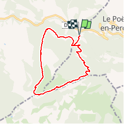
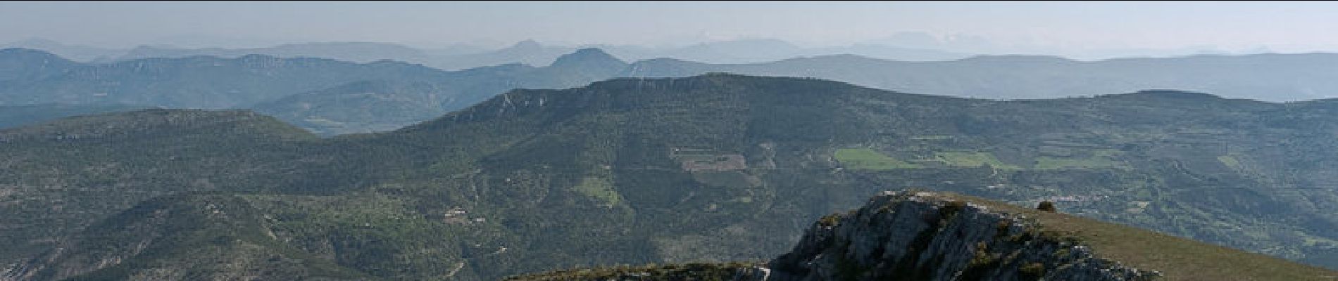
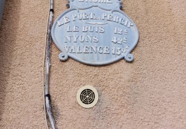
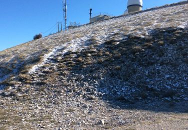
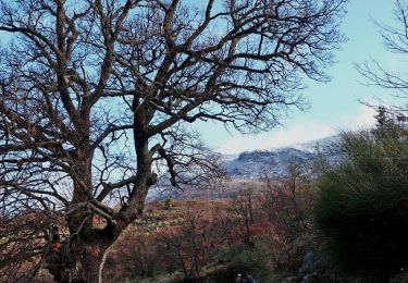
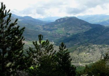
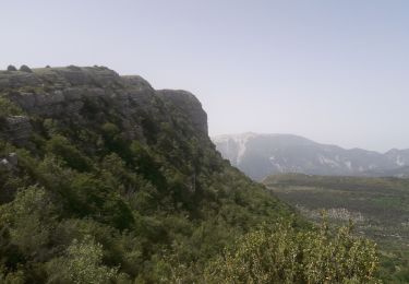
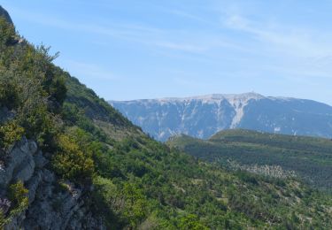
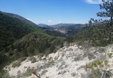
Drôme provençale, Baronnies. Depuis la Gravouse, lieu-dit du Poët-en-Percip, les chemins forestiers du Bois de Banne, permettent d'accéder au bord Sud de la Montagne de Banne. L'itinéraire monte maintenant la douce crête de l'alpage pour aller traverser les deux sommets de la montagne avant de descendre les Grands Rochers de la Montagne de Banne en passant par la Passière de Bays. Suit une raide descente aventureuse hors sentier à travers les buis pour rattraper la lisière d'un grand champ de lavande et rejoindre le point de départ. Un peu de chance permettra de surprendre des chamois au Sud Ouest de la montagne. Description complète sur sentier-nature.com : La Montagne de Banne, 1382m Remarque. Certains passages de cet itinéraire de montagne sont hors sentiers, escarpés et/ou exposés, il est déconseillé aux enfants non accompagnés et aux personnes sujettes au vertige. Pour votre sécurité, nous vous invitons à respecter les règles suivantes : être bien chaussé, ne pas s'engager par mauvais temps, ne pas s'écarter de l'itinéraire.
Localisation
Commentaires
Randonnées à proximité
![Randonnée Marche Le Poët-en-Percip - Le Poèt du Bout du Monde - Photo](https://media.geolcdn.com/t/375/260/1569e818-5455-4f23-8c9a-380b223c1c41.jpg&format=jpg&maxdim=2)
![Marche Marche](https://static1.geolcdn.com/sitytour/trail-icons/101.png)
Marche
![](/images/other/stat-length.png)
![](https://static1.geolcdn.com/siteimages/upload/files/16400158638029165_repeat_loop_refresh_sync_direction_icon.png)
![Randonnée Marche Aulan - 26 Aulan Poët en Percip - Photo](https://media.geolcdn.com/t/375/260/46c7bb6d-0b90-4bb1-97bc-ec1d2b520019.jpg&format=jpg&maxdim=2)
![Marche Marche](https://static1.geolcdn.com/sitytour/trail-icons/101.png)
Marche
![](/images/other/stat-length.png)
![](https://static1.geolcdn.com/siteimages/upload/files/16400158638029165_repeat_loop_refresh_sync_direction_icon.png)
![V.T.T. V.T.T.](https://static1.geolcdn.com/sitytour/trail-icons/202.png)
V.T.T.
![](/images/other/stat-length.png)
![](https://static1.geolcdn.com/siteimages/upload/files/16400158638029165_repeat_loop_refresh_sync_direction_icon.png)
![Randonnée Marche La Roche-sur-le-Buis - Tour de Bridons - Photo](https://media.geolcdn.com/t/375/260/ext.jpg?maxdim=2&url=https%3A%2F%2Fstatic1.geolcdn.com%2Fsiteimages%2Fupload%2Ffiles%2F1553511878bg_sport_marche.png)
![Marche Marche](https://static1.geolcdn.com/sitytour/trail-icons/101.png)
Marche
![](/images/other/stat-length.png)
![](https://static1.geolcdn.com/siteimages/upload/files/16400158638029165_repeat_loop_refresh_sync_direction_icon.png)
![Randonnée Marche Plaisians - De Plaisians à Brantes - Photo](https://media.geolcdn.com/t/375/260/ext.jpg?maxdim=2&url=https%3A%2F%2Fservices.sitytrail.com%2FGeolivesWS%2FDownloadMedia.ashx%3FTrailID%3D105349%26Media%3D9051_1.jpg)
![Marche Marche](https://static1.geolcdn.com/sitytour/trail-icons/101.png)
Marche
![](/images/other/stat-length.png)
![](https://static1.geolcdn.com/siteimages/upload/files/16400158638029165_repeat_loop_refresh_sync_direction_icon.png)
![Randonnée Marche Le Poët-en-Percip - Le Poët en Percip - Aulan - Montagne de la Bohémienne - Photo](https://media.geolcdn.com/t/375/260/ext.jpg?maxdim=2&url=https%3A%2F%2Fservices.sitytrail.com%2FGeolivesWS%2FDownloadMedia.ashx%3FTrailID%3D105312%26Media%3D9003_3.jpg)
![Marche Marche](https://static1.geolcdn.com/sitytour/trail-icons/101.png)
Marche
![](/images/other/stat-length.png)
![](https://static1.geolcdn.com/siteimages/upload/files/16400158638029165_repeat_loop_refresh_sync_direction_icon.png)
![Randonnée Marche Le Poët-en-Percip - montagne de Banne - Photo](https://media.geolcdn.com/t/375/260/df287183-f394-4400-ab94-4b4c9f2a8c15.jpg&format=jpg&maxdim=2)
![Marche Marche](https://static1.geolcdn.com/sitytour/trail-icons/101.png)
Marche
![](/images/other/stat-length.png)
![](https://static1.geolcdn.com/siteimages/upload/files/16400158638029165_repeat_loop_refresh_sync_direction_icon.png)
![Randonnée Marche Le Poët-en-Percip - Banne & Bohémienne - Photo](https://media.geolcdn.com/t/375/260/54637e79-6b70-4ef0-b1ae-314f2c7271bb.jpg&format=jpg&maxdim=2)
![Marche Marche](https://static1.geolcdn.com/sitytour/trail-icons/101.png)
Marche
![](/images/other/stat-length.png)
![](https://static1.geolcdn.com/siteimages/upload/files/16400158638029165_repeat_loop_refresh_sync_direction_icon.png)
![Randonnée Marche Le Poët-en-Percip - Le poet en percip - Photo](https://media.geolcdn.com/t/375/260/84130dd8-25b8-420d-8b47-d36842b97da8.jpg&format=jpg&maxdim=2)
![Marche Marche](https://static1.geolcdn.com/sitytour/trail-icons/101.png)
Marche
![](/images/other/stat-length.png)
![](https://static1.geolcdn.com/siteimages/upload/files/16400158638029165_repeat_loop_refresh_sync_direction_icon.png)